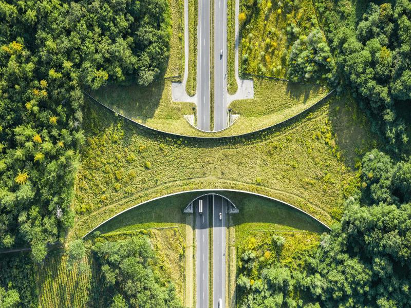
Wildlife corridors work when they do more than attract an occasional animal. The strongest projects reconnect useful habitat and produce measurable outcomes: safer movement, fewer wildlife-vehicle collisions, breeding across barriers, durable land protection, and conservation benefits that nearby communities can share.
The seven wildlife corridor success stories below range from highway overpasses in Canada to a forest bridge in Singapore and a state-scale land network in Florida. Each has evidence of progress. None is a finished solution, and that distinction matters.
Last fact-checked: August 2026. Project figures can change as new land is protected, restored, or developed.
Key takeaways
- Banff provides unusually strong evidence: fencing and 44 crossings reduced collisions, while genetic research documented bears moving and breeding across the Trans-Canada Highway.
- Large landscape programs need more than a map: Yellowstone to Yukon, the Florida Wildlife Corridor, and the European Green Belt depend on land protection, restoration, policy, and long-term coordination.
- Animal use is only the first test: a camera-trap photo proves passage, not population recovery or gene flow.
- People are part of corridor performance: projects are less durable when neighboring communities absorb conflict costs without receiving meaningful benefits.
- Connectivity has tradeoffs: poorly planned links can also help spread disease, invasive species, or fire, so monitoring and risk assessment are essential.
What is a wildlife corridor?
A wildlife corridor is a defined area managed to maintain or restore ecological connectivity between habitats. It may be a broad landscape, a river valley, a strip of forest, a series of stepping-stone habitats, or a seasonal migration route. The IUCN connectivity guidelines stress that corridors should complement protected and conserved core areas rather than replace them.
This principle is also reflected in the Kunming–Montreal Global Biodiversity Framework’s Target 3, which calls for protected and conserved areas to form well-connected and equitably governed systems.
A wildlife crossing is more specific: it is an overpass, underpass, culvert, canopy bridge, or other structure that helps animals cross a road, railway, canal, fence, or similar barrier. A crossing can repair one break in a much larger corridor, but the structure is useful only when animals can reach suitable habitat on both sides.
Connectivity matters because isolated populations may lose access to food, seasonal range, mates, and recolonization routes. It can also affect how biologists understand and protect a species and its distinct populations. In a meta-analysis of 78 experiments from 35 studies, researchers found that corridors increased movement between habitat patches by about 50% compared with unconnected patches. That is meaningful evidence, but movement alone does not prove long-term demographic or genetic recovery.
How to tell whether a corridor is successful

Success should be measured in layers. A project becomes more convincing as evidence moves from simple use toward survival, reproduction, population connectivity, and durable governance.
| Evidence level | Useful measures | What the evidence shows | What it does not prove by itself |
|---|---|---|---|
| Animal use | Tracks, cameras, acoustic sensors, GPS locations | Target species can find and enter the route | Safer movement, breeding, or population recovery |
| Safety | Roadkill and collision trends before and after mitigation | The intervention reduces direct mortality at a barrier | Connectivity across the wider landscape |
| Functional connectivity | Genetics, parentage, recolonization, seasonal migration | Animals move in ways that affect populations | That every species benefits equally |
| Durable habitat protection | Protected status, easements, restoration, funded maintenance | The route is less likely to disappear after a short project cycle | That habitat quality and climate suitability will remain adequate |
| Human outcomes | Conflict rates, compensation, local participation, benefit sharing | The project has a stronger basis for long-term coexistence | Ecological effectiveness without biological monitoring |
Wildlife corridor success stories at a glance
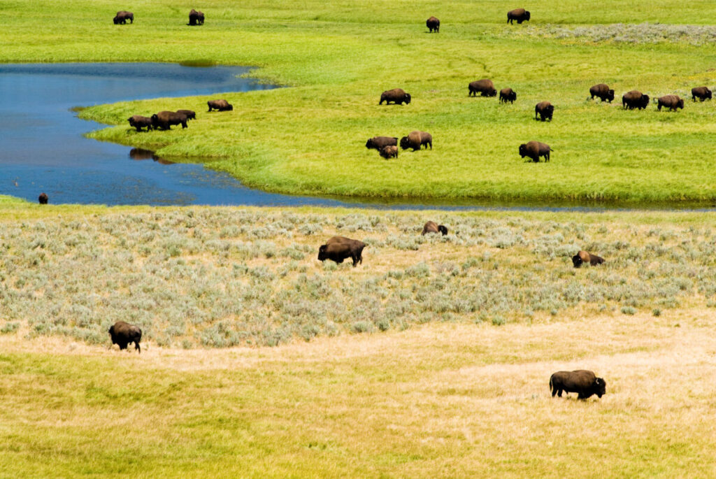
| Project | Location | Main intervention | Best evidence of progress | Important limitation |
|---|---|---|---|---|
| Banff wildlife crossings | Canada | Fencing, overpasses, and underpasses | Lower collision rates plus documented bear gene flow and reproduction | Some species use structures less readily than others |
| Yellowstone to Yukon | United States and Canada | Large-landscape protection and barrier mitigation | Accelerated protected-area growth after the 1993 vision began | The region still contains major protection and connectivity gaps |
| Florida Wildlife Corridor | United States | State law, land acquisition, easements, and restoration | More than 98,000 critical corridor acres acquired in 2025 | Millions of opportunity acres remain unprotected |
| European Green Belt | 24 European countries | Transnational ecological network along the former Iron Curtain | More than 12,500 kilometers organized under a shared conservation framework | It is not one continuous, uniformly protected habitat strip |
| Mount Kenya Elephant Corridor | Kenya | Fenced route and highway underpass | Repeated elephant use and use by other species reported by the operator | Publicly reported figures rely heavily on project monitoring |
| Eco-Link@BKE | Singapore | Vegetated bridge between nature reserves | Around 100 fauna species recorded from 2018 to 2021 | Species detections do not by themselves establish population-level gains |
| Khata Corridor | Nepal–India border | Community-managed transboundary forest | Evidence of resident and transient tiger use | Human–tiger conflict and unequal benefits threaten coexistence |
1. Banff wildlife crossings: from animal passage to gene flow

Banff National Park has one of the clearest demonstrations that road mitigation can improve both safety and connectivity. Along 82 kilometers of the Trans-Canada Highway, Parks Canada reports 44 wildlife crossing structures—six overpasses and 38 underpasses—paired with highway fencing.
The fencing and crossings have reduced wildlife-vehicle collisions by more than 80% overall and by more than 96% for elk and deer, according to Parks Canada. The combination matters: fencing keeps large animals off the road and guides them toward structures placed along likely movement routes.
Banff also has stronger evidence than a simple crossing count. A three-year genetic study found bidirectional gene flow and genetic mixing across the highway. Among bears detected using the crossings, parentage tests showed that 47% of black bears and 27% of grizzly bears successfully bred. Some offspring were detected on both sides of the road.
Why it counts as success: Banff links three evidence layers—reduced mortality, repeated animal movement, and reproduction across a major transport barrier.
What remains: crossing design is species-specific. Parks Canada notes that cautious animals may take years to adapt, while research elsewhere in the mountain parks shows that some species, including wolverines, remain difficult to reconnect. Human entry to Banff crossing structures is prohibited because disturbance can reduce wildlife use.
2. Yellowstone to Yukon: measurable progress across a 3,400-kilometer region
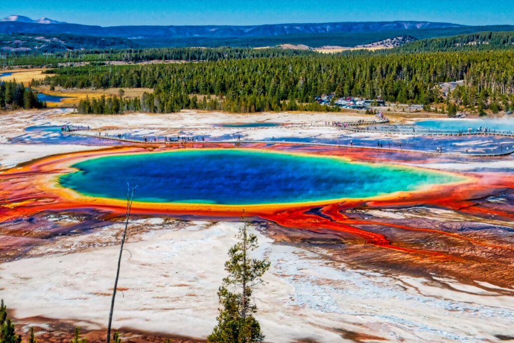
The Yellowstone to Yukon Conservation Initiative, usually shortened to Y2Y, is better understood as a large-landscape conservation vision than as one continuous corridor. Its 1.3-million-square-kilometer region extends about 3,400 kilometers along the Rocky Mountains from the Greater Yellowstone Ecosystem to Canada’s Yukon Territory.
Y2Y began in 1993 to coordinate habitat protection, road crossings, private-land conservation, coexistence work, and policy across jurisdictions. That makes attribution difficult: no single organization created every protected area or crossing within the region.
Still, a 2021 peer-reviewed assessment found substantial conservation gains after the vision began. From 1993 to 2018, designated protected areas in the study region increased by about 107,290 square kilometers. The rate of protected-area growth increased by 90% after 1993, while growth slowed or stayed comparatively flat in adjacent regions and across North America. The authors described Y2Y as a contributing large-landscape strategy rather than claiming it was the sole cause.
Why it counts as success: Y2Y offers a rare counterfactual evaluation of a conservation vision, with measurable change in protected-area coverage and road-crossing infrastructure over decades.
What remains: protected acreage is not the same as seamless connectivity. The region still contains highways, energy development, forestry pressure, private-land gaps, and isolated wildlife populations. The project’s value lies partly in treating those gaps as one connected planning problem.
3. Florida Wildlife Corridor: turning a connectivity map into land protection
The Florida Wildlife Corridor shows how ecological modeling can shape law and land acquisition. The statewide network covers more than 18 million acres, including roughly 10 million acres already conserved and millions more identified as opportunities for protection.
Florida enacted the Wildlife Corridor Act in 2021, formally recognizing the network and supporting conservation purchases. The state’s 2026 Florida Forever Plan reports that more than 98,000 critical acres within the corridor were acquired in 2025. Those acquisitions included watersheds, pine savannas, forests, ranchlands, springs, and greenway connections.
This is a different type of success from an overpass. The intervention is not one structure; it is the gradual protection of a network through public purchases, conservation easements, restoration, and partnerships with landowners and land trusts.
Why it counts as success: the corridor moved from a scientific planning concept into state law, budget priorities, and documented land acquisition.
What remains: unprotected parcels can become bottlenecks if development severs them before conservation agreements are completed. Florida also must manage habitat quality, water systems, roads, invasive species, and climate exposure within the mapped network.
4. European Green Belt: a 24-country conservation framework

The European Green Belt follows the route of the former Iron Curtain for more than 12,500 kilometers through 24 countries. Decades of restricted access left many border landscapes less intensively developed than surrounding areas. After the Cold War, conservation groups and public agencies began coordinating those habitats as a pan-European ecological network.
The Green Belt includes northern forests, rivers, wetlands, grasslands, agricultural landscapes, and coastal areas. Its strength is institutional as much as biological: organizations in four broad regions work under a shared vision while carrying out local protection, restoration, research, and community projects.
Why it counts as success: a former political divide now provides a long-term framework for transboundary conservation across almost an entire continent.
What remains: the European Green Belt is not one uninterrupted, equally protected strip. Habitat quality, legal status, road density, and management capacity vary sharply by country and region. Its ecological claims should therefore be assessed project by project, not inferred from the network’s total length.
5. Mount Kenya Elephant Corridor: a targeted route through farms and a highway

The Mount Kenya Elephant Corridor reconnects Mount Kenya’s forests with lower-elevation habitats and the wider Laikipia ecosystem. The approximately 9.8-kilometer route combines fencing with an underpass beneath the busy Nanyuki–Meru highway, directing elephants through a safer path across cultivated land and transport infrastructure.
The first documented elephant used the underpass soon after it opened. The current project operator, Mount Kenya Trust, reports more than 2,000 elephant journeys through the corridor annually and records 19 other key species using it.
Why it counts as success: the project addresses a specific severed route with a structure, guiding fences, land agreements, and ongoing monitoring rather than expecting elephants to navigate farms and traffic unaided.
What remains: the use figures are primarily reported by the operator, so independently published long-term evidence on survival, conflict reduction, and population connectivity would strengthen the case. Fences also require maintenance and can redirect animals toward new pressure points if the surrounding landscape changes.
6. Eco-Link@BKE: reconnecting forest reserves in a dense city

Singapore’s Eco-Link@BKE is a vegetated bridge over the Bukit Timah Expressway. Built in 2013, it reconnects the Bukit Timah Nature Reserve and Central Catchment Nature Reserve, which the highway had separated.
Singapore’s National Parks Board reported that around 100 fauna species were recorded using the bridge between 2018 and 2021, including 31 species recorded there for the first time. In October 2023, the critically endangered Raffles’ banded langur was observed on the bridge.
Why it counts as success: Eco-Link@BKE shows that dense urban infrastructure does not make ecological repair impossible. Native vegetation, reserve-to-reserve placement, and a decade of maturation created a usable forest connection rather than a bare concrete crossing.
What remains: species detections establish use, but not necessarily gene flow or population growth. The next evidence tier would compare genetics, breeding, mortality, and movement patterns before and after the link.
7. Khata Corridor: tiger connectivity with a human coexistence test

The Khata Corridor links Nepal’s Bardiya National Park with India’s Katarniaghat Wildlife Sanctuary through community-managed forest near the international border. An Oryx assessment documented resident and transient tigers, supporting the conclusion that the forest functions as a biological corridor.
Khata also shows why ecological use cannot be the only measure. A 2024 Oryx study described the area as one of Nepal’s higher human–wildlife conflict zones. Conflict risk was associated with forest use, settlement location, and an unequal distribution of tourism benefits.
Why it counts as success: the corridor supports transboundary tiger movement and has benefited from community forestry and local participation.
What remains: long-term coexistence depends on reducing livestock and human risk, improving access to conservation benefits, and recognizing that poorer or more remote communities may carry disproportionate costs. A corridor that works for tigers but becomes intolerable for people is not secure.
What successful corridor projects have in common

- They connect valuable habitat. A narrow passage between degraded endpoints does little for wildlife. Core areas on both sides must provide food, shelter, breeding habitat, or seasonal range.
- They address the actual barrier. Highway fencing and crossings solve a different problem from land acquisition, river restoration, or transboundary policy. The intervention must match the species and threat.
- They guide animals safely. Overpasses and underpasses are often paired with fencing, vegetation, noise control, suitable dimensions, and placement based on movement data.
- They measure outcomes in stages. Monitoring should progress from detection to collision reduction, survival, reproduction, gene flow, and population response where feasible.
- They have durable protection and maintenance. Legal status, easements, restoration funding, and inspection matter because a corridor can fail after a fence breaks or a bottleneck is developed.
- They involve affected communities. Participation, compensation, livelihood options, Indigenous and local rights, and fair benefit sharing are practical requirements—not public-relations extras.
- They adapt. Wildlife behavior, traffic, land use, climate, disease, and fire regimes change. Good projects revise management when monitoring reveals a new risk.
Where wildlife corridors can fail or cause harm
Connectivity is usually discussed as an ecological benefit, but more connection is not automatically better in every place. A 2025 review in Nature Reviews Biodiversity argued that planners should also assess potential costs.
- Disease and parasites: movement routes can increase contact among populations and carry pathogens into previously separated areas.
- Invasive species: the same route that helps native species move may assist invasive plants, predators, or competitors.
- Fire: continuous vegetation can alter how fire travels through a fragmented landscape.
- Ecological traps: animals may be guided toward poor habitat, roads, fences, hunting pressure, or conflict hotspots.
- Predation and competition: a link can change predator-prey relationships or expose vulnerable populations to new competitors.
- Human costs: crop damage, livestock loss, safety concerns, restricted land use, or unequal enforcement can undermine support.
These risks do not make corridors a bad strategy. They make baseline studies, species-specific design, local consultation, and long-term monitoring necessary.
How to evaluate or support a credible corridor project
- Look for a clear map of the core habitats, bottleneck, barrier, and land ownership—not only a promotional project name.
- Check whether the project publishes baseline data and explains how success will be measured.
- Distinguish operator-reported animal detections from peer-reviewed evidence of safety, breeding, gene flow, or population change.
- Ask who maintains structures, fencing, vegetation, and monitoring after construction funding ends.
- Review how Indigenous Peoples, landowners, farmers, and nearby communities participate and share benefits.
- Support land trusts, community conservation groups, restoration programs, and road-mitigation projects that disclose methods and results.
- Do not enter, stop beside, bait wildlife near, or fly drones over restricted crossing structures. Disturbance can change animal behavior and weaken monitoring data.
Anyone documenting these projects should also follow ethical wildlife photography fieldcraft, especially around migration routes, denning areas, and crossings designed to minimize human disturbance.
Frequently asked questions
What is a wildlife corridor?
A wildlife corridor is a defined area managed to maintain or restore ecological connectivity between habitats. It can be a broad landscape, river corridor, forest strip, stepping-stone network, seasonal route, or a route repaired with engineered crossings.
Do wildlife corridors actually work?
Yes, many increase animal movement, and some reduce mortality or restore gene flow. Evidence strength varies. A camera-trap detection proves use, while collision data, genetics, reproduction, and population trends provide stronger tests of ecological success.
What is the difference between a wildlife corridor and a wildlife crossing?
A corridor is the larger connected route or landscape. A wildlife crossing is a structure, such as an overpass, underpass, culvert, or canopy bridge, built to repair one barrier within that route.
What is the best-known wildlife crossing system?
Banff National Park has one of the world’s best-studied systems. Its 44 crossings and highway fencing reduced wildlife-vehicle collisions, and genetic research documented black bears and grizzly bears moving and breeding across the highway.
Can wildlife corridors help species adapt to climate change?
They can help some species shift ranges, reach climate refuges, and maintain larger connected populations. Results depend on habitat quality, route direction, barriers, land protection, and whether suitable conditions remain available at the destination.
Can wildlife corridors cause problems?
Yes. Connectivity can also spread disease, invasive species, fire, predators, or conflict. Planners should compare benefits and risks, protect core habitat, involve affected communities, and monitor outcomes over time.
What real corridor success looks like
A wildlife corridor is not successful because it looks green on a map or because one animal crossed it. The strongest evidence shows sustained movement between useful habitats, lower mortality, reproduction or genetic exchange, durable protection, and governance that nearby people can live with.
Banff demonstrates what a well-monitored road intervention can achieve. Yellowstone to Yukon and Florida show how policy and land protection can work at landscape scale. Singapore and Mount Kenya show how a carefully placed structure can repair a specific barrier. Khata shows that ecological connectivity and human equity must be managed together.
These projects do not prove that every proposed corridor will work. They show that fragmented landscapes can be reconnected when conservationists define the problem precisely, choose the right intervention, publish evidence, and keep adapting after construction or designation.